


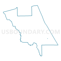
Voting District 909R, Volusia County, Florida
About
Outline

Summary
| Unique Area Identifier | 559942 |
| Name | Voting District 909R |
| County | Volusia County |
| State | Florida |
| Area (square miles) | 0.03 |
| Land Area (square miles) | 0.03 |
| Water Area (square miles) | 0.00 |
| % of Land Area | 100.00 |
| % of Water Area | 0.00 |
| Latitude of the Internal Point | 28.89563180 |
| Longtitude of the Internal Point | -80.85922710 |
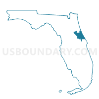
Maps

Graphs
Select a template below for downloading or customizing gragh for Voting District 909R, Volusia County, Florida


Neighbors
Neighoring Voting District (by Name) Neighboring Voting District on the Map
- 907-Voting District, Volusia County, FL
- 908-Voting District, Volusia County, FL
- 909A-Voting District, Volusia County, FL
- Voting District 909S, Volusia County, FL
- Voting District 909U, Volusia County, FL